Route from Alcúdia · start & finish Alcúdia
Alcúdia – Formentor
- Moderate
- 67 km
- 1,030 m
- ≈ 3–3½ h
Map and elevation profile
Move along the elevation profile to see where you are on the map.
Food & coffee stops
Tried-and-tested places where cyclists like to stop for coffee, food or water.
-
Café 8 kmPascal Bistro Velo Port de Pollença
A bike-themed bistro on the seafront at Passeig Saralegui 130, also on the route in Port de Pollença, with sea views. It opens daily from 7:00: breakfast and coffee on the way out, or a pizza or salad on the way back (km 46).
Open in maps ↗ -
Restaurant 9 kmTolo's Port de Pollença
A well-known cyclists' meeting point on the Port de Pollença seafront, right on the route at km 8 (Passeig de Londres 4). It opens at 8:00, serves Mediterranean food from the Josper charcoal oven and is open all year. Closed on Mondays; open until 17:00 on Sundays.
Open in maps ↗ -
Café 28 kmCafetería Faro de Formentor Formentor
The only refreshments beyond Platja de Formentor, right at the lighthouse at km 28: coffee, cold drinks and snacks with a view over the cliffs. It has been running since 1995 and is operating in 2026. Cycling guides give its usual hours as roughly 10:00–16:00 from March to October, and it can close without warning in bad weather.
Open in maps ↗
Cap de Formentor: to the lighthouse at Mallorca's northern tip
Route summary:
The ride almost every guest in the north asks for: along the Bay of Pollença and over the Mirador es Colomer to the lighthouse at the tip of Formentor. It is 66.5 km with about 1,030 m of climbing, yet no climb exceeds 7.1 km and the steepest pitches touch 10%. It is out and back, so you ride the Colomer and the ridge before the lighthouse both ways. Fit riders with a few hilly rides in their legs will enjoy it. Count on 3 to 3.5 hours of riding, 4 to 5 with stops. Refuel in Port de Pollença (km 8 and 46) or at the lighthouse café (km 28). The flat way home follows the quiet Camí de Llenaire, not the busy bay road.
 Cycling route summary:
Km 0–10: flat. Mostly on the cycle path beside the Ma-2220, you follow the bay to Port de Pollença. Roll slowly along the seafront (Passeig de Londres, Passeig Saralegui) and out on Carrer de Formentor.
Km 10–14: the Ma-2210 climbs 3.1 km at 6.3% (max 8%) through three hairpins to the Mirador es Colomer, 208 m. Then 3.5 km of hairpins drop to the Platja de Formentor turn-off (km 17).
Km 17–28: until 18 October 2026, a barrier here stops private cars from 10:00 to 22:00; beyond it you meet only TIB bus 334 and authorised vehicles. The road rises 7.1 km at 3.2% (max 7%) through pines and a lit, roughly 300 m tunnel (km 22) to the high point, 221 m (km 24), then rolls down to the lighthouse with a short final ramp (km 28).
Km 28–46: back the same way. From the lighthouse, 3.1 km at 3.9%, steepest right at the start (about 75 m in 800 m, max 10%). From the beach, 3.5 km at 5.8% (max 9%) to the Mirador (km 42), then down to Port de Pollença.
Km 46–66.5: the quiet Camí de Llenaire rises almost imperceptibly to about 45 m below Pollença (km 55); farm lanes lead back to Alcúdia. In a tramuntana, expect strong gusts on the cape.
 Tourist summary:
Alcúdia's walls, begun in 1298 under King Jaume II, see you off and welcome you back; the Roman ruins of Pollentia lie just outside them. Port de Pollença is a relaxed harbour town with a long seafront. At the Mirador es Colomer, climb the steps to terraces high above the sea and the islet of Es Colomer; a monument there honours Antoni Parietti, the engineer behind the road that opened in 1925. Below lies Platja de Formentor, where the legendary Hotel Formentor opened in 1929. The lighthouse (1863) shines from 210 m above the sea, higher than any other in the Balearics. On the way home, Pollença's Plaça Major and the 365 Calvari steps are a short detour.
Climbs click to show on the map
- Coll de la Creueta – Mirador es Colomer from Port de Pollença 3.1 km · Ø 6.3 % · max. 8.2 % · top 208 m km 11–14
- Cap de Formentor (Ma-2210) from Platja de Formentor 7.1 km · Ø 3.2 % · max. 7.3 % · top 221 m km 17–25
- Cap de Formentor (Ma-2210) from Far de Formentor 3.1 km · Ø 3.9 % · max. 10.2 % · top 221 m km 29–32
- Coll de la Creueta – Mirador es Colomer from Platja de Formentor 3.5 km · Ø 5.8 % · max. 8.8 % · top 208 m km 39–42
Tips from our guides
- Until 18 October 2026, private cars and motorbikes may not go beyond Platja de Formentor between 10:00 and 22:00; cyclists can ride at any time. Past the barrier you will meet only TIB 334 buses and authorised vehicles, but the Colomer climb before it carries beach traffic all day. Outside the restriction period, start early and leave the cape before midday.
- The tunnel at km 22 (and again at km 34 on the way back) is lit, but coming in from bright sun it feels dark. Switch on front and rear lights and take off your sunglasses before you ride in.
- Fill both bottles in Port de Pollença and do not count on refills on the cape: beyond Platja de Formentor the lighthouse café is the only option, and it may close in bad weather. Take a snack too; apart from about 3 km of pine woods there is hardly any shade.
- Both descents from the Mirador es Colomer are fast, with tight hairpins. Brake before the bends and watch for buses, cars pulling out of the viewpoint car park, goats, fallen rocks and pine cones. The road is treacherous when wet. The cape is very exposed: in a northerly tramuntana, gusts can push you sideways, so keep a firm grip and a windproof in your pocket.
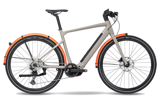
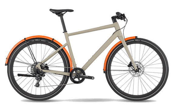
- Any road bike with compact gearing will do; 50/34 with an 11–32 cassette handles even the steep start of the climb away from the lighthouse. Mallorca Cycling Center can deliver the bike to your hotel in Alcúdia, Port d'Alcúdia, Playa de Muro or Port de Pollença.
Did you know?
- The road from Port de Pollença to Cap de Formentor opened in 1925. Its engineer, Antoni Parietti, later built the famous Sa Calobra road (1928–1933), and a monument to him has stood at the Mirador es Colomer since 1968. source
- The Formentor lighthouse, built in 1863, has its light 210 m above the sea, making it the highest lighthouse in the Balearic Islands. Its beam reaches 24 nautical miles, about 44 km. source
- Without the road there would be no Hotel Formentor: Adan Diehl opened it by the beach in 1929, four years after the road was completed. source
Places along the route
-
10 km
Alcúdia
Start and finish at the roundabout by the old-town walls on Av. dels Prínceps d'Espanya. Work on the walls began in 1298 under Jaume II, and you can walk along much of them; the Porta del Moll gate frames the narrow lanes inside. The ruins of the Roman town of Pollentia lie just outside the walls.
-
28 km
Port de Pollença
You ride the seafront roads, Passeig de Londres and Passeig Saralegui, past the harbour with the Formentor ridge ahead. Both cyclist favourites, Tolo's and Pascal Bistro Velo, sit on this seafront, and it is your last easy chance for coffee and full bottles before the cape. In season, expect pedestrians and one-way streets, so take it slowly.
-
314 km
Mirador es Colomer
The top of the first climb (208 m) and one of the most photographed stops on the peninsula. Steps lead from the car park to terraces above sheer cliffs and the islet of Es Colomer. A monument here since 1968 honours Antoni Parietti, the engineer who led the building of the Formentor road.
-
417 km
Platja de Formentor
A side road drops to the pine-fringed beach where the legendary Hotel Formentor opened in 1929. The barrier stands on the main road here: from 15 May to 18 October 2026, private cars cannot continue towards the lighthouse between 10:00 and 22:00, while bikes may pass at any time.
-
522 km
Fumat tunnel
The tunnel of about 300 m under the Fumat ridge is lit, but the change from bright sun to gloom is sudden. Switch on front and rear lights and take off your sunglasses before you enter. You ride through it again at km 34 on the way back.
-
628 km
Far de Formentor
The turnaround at Mallorca's northern tip. The lighthouse was built in 1863 and, with its light 210 m above the sea, is the highest in the Balearic Islands. From the café you look over sheer cliffs, and on clear days you can see Menorca to the east.
-
751 km
Camí de Llenaire
A quiet lane that leaves Port de Pollença and runs past fields and country houses to the edge of Pollença. Traffic is light, and it gains only about 40 m in roughly 4.5 km. A far calmer way home than the main road between the port and the town.
-
856 km
Pollença
The route skirts the east side of town, with Plaça Major about half a kilometre away. From there, 365 cypress-lined steps climb to the Calvari chapel, and Puig de Maria (333 m) with its sanctuary rises just south of town. The weekly market fills the square on Sundays.
More routes
All routes →Rides of similar difficulty you might also like.