Themed route · start & finish Can Pastilla
Cala Figuera – Sa Mola
- Medium
- 111 km
- 1,243 m
- ≈ 4½–5½ h
Map and elevation profile
Move along the elevation profile to see where you are on the map.
Food & coffee stops
Tried-and-tested places where cyclists like to stop for coffee, food or water.
-
Café 51 kmCafé Mozart Santa Ponça
Café-restaurant right on the route on Santa Ponça's main square, open daily from 9:00 to midnight: breakfasts, including vegetarian and vegan options, coffee, pastries and ice cream on a large covered terrace. A good stop before the climb through Costa de la Calma.
Open in maps ↗ -
Café 66 kmBlend – brunch & speciality coffee Port d'Andratx
Speciality coffee and brunch café by the harbour: sourdough toast with local produce, pancakes, croissants, yoghurt and açaí bowls. Summer: daily 9:00–16:00; winter: Tuesday to Sunday 9:00–15:00, closed on Mondays.
Open in maps ↗ -
Café 79 kmSchwarzwald Café Peguera
German-style café by Platja de Torà: fresh cakes and pastries, coffee specialities, breakfasts, ice cream and smoothies, with beach views from the terrace. Open daily 9:00–18:00; some guests report it is sometimes cash only, so carry some. The last proper cake stop before Palma.
Open in maps ↗ -
Café 95 kmElefante Sant Agustí Sant Agustí
Healthy café by the Cala Nova marina, right on the Ma-1C: breakfast and brunch, avocado toast, pancakes, açaí bowls, salads and smoothies, with vegetarian, vegan and gluten-free options. You pass it twice – at km 17 and again at km 94. Open 9:00–15:00, closed on Tuesdays.
Open in maps ↗
Lighthouse to lighthouse: Portopí, Cala Figuera and sa Mola
Route summary:
Three lighthouses, a string of pine-fringed coves and not a metre of motorway: this 111 km loop with about 1,250 m of climbing follows the old coast roads of Calvià from Can Pastilla to the western cape of the Bay of Palma and on to Port d'Andratx. You pass Portopí, one of the oldest working lighthouses in the world, take two dead-end roads to the coves of Portals Vells and to the barrier below the Cala Figuera lighthouse, and turn at the sa Mola lighthouse after a steep final kilometre. It suits fit riders who enjoy short climbs and can handle resort traffic. Allow 4.5–5.5 hours of riding plus time for walks, and refuel in Sant Agustí, Santa Ponça, Port d'Andratx and Peguera.
 Cycling route summary:
Km 0–11 is the flat seafront bike path via Portixol and the Parc de la Mar to the end of the Passeig Marítim at Porto Pi. Leaving the port, you climb just over a kilometre at around 7% to about 85 m in La Bonanova, then Carrer de Saridakis drops you to Cala Major. The Ma-1C rolls through Sant Agustí and Illetes (km 17) and over the Costa d'en Blanes rise (about 40 m) to Portals Nous, and the passeig de Calvià follows the sea to Palmanova and Magaluf. The Ma-1 motorway is off-limits to bikes.
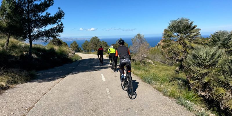
Two out-and-back spurs follow: over a 70 m hump to Cala Portals Vells (km 29.8), then from La Porrassa up the Cala Figuera road (2.7 km at 2.9%) to the barrier (km 38.9). Past Santa Ponça (km 50) you climb about 3 km through Costa de la Calma to 80 m, drop to Peguera and roll on to Camp de Mar. The Collet de Cala Blanca (1.4 km, 5.7%) leads to Port d'Andratx (km 64.8); along the harbour and Camí de Sant Carles you reach Carrer Pi, which rears up to sa Mola: 1 km at 8.5%, the steepest 100 m at 15.5%. Home over Cala Blanca (2.4 km, 3.6%), Costa de la Calma and the Bonanova hill (96 m, km 97).
 Tourist summary:
A ride through Mallorca's maritime history. Palma's Gothic cathedral sees you off, and at Porto Pi a light has guided ships since around 1300. In Cala Major you pass the Fundació Pilar i Joan Miró, next to the studios where the painter worked from 1956 until his death in 1983. At Portals Vells a cave in the rock is in fact a medieval quarry that supplied stone for the cathedral. The Cala Figuera lighthouse (1860) and a 16th-century watchtower guard the bay's western cape, and at Santa Ponça King James I landed in September 1229 to conquer the island. The turning point is Port d'Andratx, its yachts watched over by the sa Mola lighthouse.
Climbs click to show on the map
- Cala Figuera from La Porrassa (Magaluf), km 36 2.7 km · Ø 2.9 % · max. 6.3 % · top 85 m km 36–39
- Collet de Cala Blanca from Camp de Mar, km 61 1.4 km · Ø 5.7 % · max. 9.2 % · top 91 m km 61–63
- Sa Mola from Port d'Andratx (Camí de Sant Carles), km 67 1 km · Ø 8.5 % · max. 15.5 % · top 104 m km 67–68
- Collet de Cala Blanca from Port d'Andratx, km 71 2.4 km · Ø 3.6 % · max. 9.7 % · top 92 m km 71–74
Tips from our guides
- Start by 9:00: with the walks at Portals Vells and Cala Figuera this is a full day. Sunset in Palma is around 19:35 at the end of September, about 17:55 after the clocks change on 25 October and around 17:25 in December. If you might finish in the dark, Spanish rules require a white front light, a red rear light and a reflective garment on interurban roads at night.
- Bring a lock and shoes you can walk in. Bikes stay off the beaches: lock up at the Portals Vells car park, at the beach in Camp de Mar and at the Cala Figuera barrier – from there the lighthouse is about 25–30 minutes on foot each way, a slog in cleats. Top up your bottles in Magaluf before the two dead-end spurs.
- Carrer Pi to sa Mola averages 8.5% and its steepest 100 m hit 15.5%, with a rough surface and two hairpins: a compact chainset with a 30- or 32-tooth sprocket turns a grind into fun. It's a narrow residential dead end, so descend slowly. About 1.8 km of the route is service road or paving, where 28 mm tyres pay off.
- Bikes are banned from the Ma-1 motorway and Palma's Via de Cintura ring road. Around Porto Pi and Cala Major stick to the route's streets and never take a motorway slip road. The seafront path and the passeig de Calvià are shared with walkers and scooters, and in summer Magaluf, Santa Ponça and Peguera mean busy roundabouts – ride calmly, ideally early.
- On summer days the embat sea breeze sets in over the Bay of Palma from mid-morning. It blows from the south-west and usually peaks between 14:00 and 16:00: expect a headwind on the way out to Andratx and, more often than not, a push on the way home.
Did you know?
- IALA lists Palma's Portopí lighthouse as the third-oldest working lighthouse in the world. A light is documented there from around 1300, and until 1971 the tower also signalled arriving ships to the city, first with tarred balls and later with flags. source
- The sa Mola lighthouse, lit on 1 September 1974, belongs to the first generation of lighthouses built without keepers' quarters – the technicians who maintained it lived down in Port d'Andratx. Its tower is just 10 m tall, yet the light shines from 128 m above the sea and carries 12 nautical miles. source
- The Cova de la Mare de Déu at Portals Vells is not a natural cave but a former quarry: its stone was used to build Palma Cathedral and the church of Santa Eulàlia. source
Places along the route
-
18 km
Parc de la Mar & La Seu
The bike path runs right below Palma's Gothic cathedral, reflected in the lake of the Parc de la Mar. The terrace in front of the cathedral is about 5 minutes on foot up the steps; lock the bike, as the promenade is always busy.
-
211 km
Porto Pi – Portopí lighthouse
From the end of the Passeig Marítim you look across the harbour to the Portopí lighthouse. A light is documented here from around 1300, it has shone from today's signal tower since 1617, and IALA lists it as the world's third-oldest working lighthouse. It stands inside the port: the Balearic Port Authority runs free guided tours of its maritime-signals exhibition by prior appointment only.
-
317 km
Sant Agustí & Illetes
Here the Ma-1C passes the Cala Nova marina in Sant Agustí and continues above Illetes, named after the small islets off its coves. A little earlier you ride down Carrer de Saridakis in Cala Major, past the Fundació Pilar i Joan Miró and the painter's studios. About 4 km further on is the upmarket Puerto Portals marina.
-
430 km
Cala Portals Vells
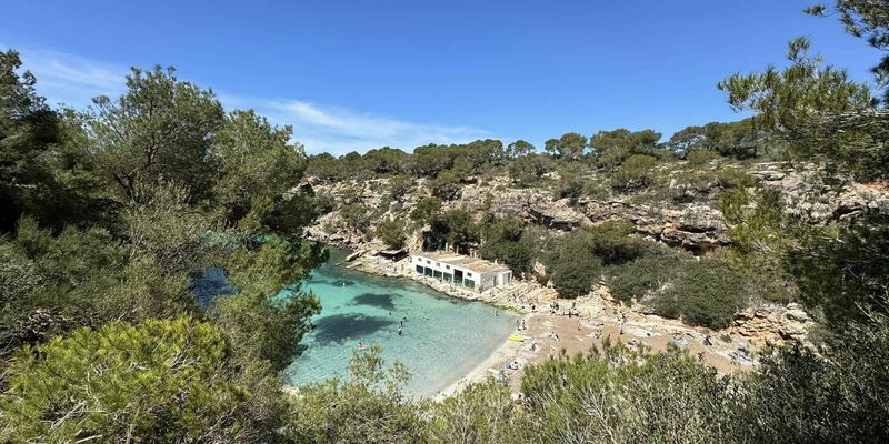
The road ends above a cluster of coves in the pine forest. Lock the bike at the car park and walk the last few metres – bikes are not allowed on the beach. On the shore is the Cova de la Mare de Déu, a medieval quarry that supplied stone for Palma Cathedral and the church of Santa Eulàlia; the Torre des Moro watchtower dates from 1580.
-
539 km
Cap de Cala Figuera
Cars stop at a barrier; beyond it lies former military land, where a coastal battery was disarmed in 1996. The Cala Figuera lighthouse, first lit in 1860 and today a 24 m tower visible for 22 nautical miles, and a watchtower built in 1579–1582 are about 25–30 minutes' walk away. The lighthouse cannot be visited – go only with shoes you can walk in.
-
650 km
Santa Ponça
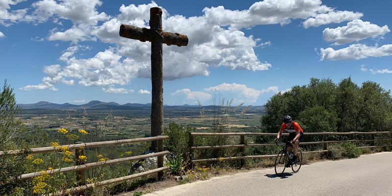
On 10 September 1229 King James I of Aragon landed here with his fleet to conquer Mallorca. On the sa Caleta headland the Creu de la Conquesta, a cross with reliefs by Tomàs Vila erected for the 700th anniversary in 1929, marks the event. Every September the Festes del Rei en Jaume stage a mock battle on the beach.
-
761 km
Camp de Mar
The route runs behind the beach; a detour of about 500 m down to the sea brings you to the local landmark – a rocky islet linked to the shore by a wooden footbridge. Lock the bike at the beach before crossing.
-
865 km
Port d'Andratx
A long, sheltered natural harbour where fishing boats and yachts share the quay along Avinguda Mateu Bosch and villas climb the hillsides. The harbour front is partly paved, so ride slowly; it's your last coffee stop before sa Mola.
-
968 km
Sa Mola lighthouse
Carrer Pi ends by the cliff-top lighthouse of Cap de sa Mola, lit on 1 September 1974: its tower is only 10 m tall, but the light sits 128 m above the sea. The lighthouse is closed to visitors; from the end of the street you look over the harbour entrance, Cala Llamp and, on clear days, Sa Dragonera.
-
1078 km
Peguera
Peguera – Paguera in Spanish and to its many German visitors – has its beaches right by the road: Platja de Torà sits next to Plaça de Torà. Time for coffee and cake before the last 33 km to Can Pastilla.
More routes
All routes →Rides of similar difficulty you might also like.