Mallorca 312 · start & finish Playa de Muro
Mallorca 312
- Epic
- 313 km
- 4,286 m
- ≈ 13–15½ h
Map and elevation profile
Move along the elevation profile to see where you are on the map.
Food & coffee stops
Tried-and-tested places where cyclists like to stop for coffee, food or water.
-
Café 39 kmRestaurant Coll de sa Bataia Coll de sa Batalla (Escorca, near Lluc)
Classic cyclists' café by the Repsol station atop Coll de sa Batalla, right on the route: self-service coffee, almond cake, bocadillos and bike racks; open daily 7–18.
Open in maps ↗ -
Café 81 kmS'Hortet Deià
Hidden garden café under lemon trees just below Deià's main road: carrot cake, fresh juices and veggie lunches; usually Tue–Sat 10–16, closed Sunday and Monday.
Open in maps ↗ -
Water 112 kmCarrer de la Síquia Estellencs
Public drinking-water tap by the Ma-10 in Estellencs: top up your bottles before the rolling coast road and the climb to Coll de sa Gramola above Andratx.
Open in maps ↗ -
Café 137 kmBar Nou Es Capdellà
Classic village bar on Es Capdellà's main street, popular with cyclists, with bike racks across the road; coffee or a hearty lunch – closed Wednesdays.
Open in maps ↗ -
Water 160 kmPlaça del Jardinet Esporles
Village tap on Plaça del Jardinet, beside the plane-tree promenade after the Coll des Grau descent; a few steps away, Doble Coffee serves specialty coffee and brunch.
Open in maps ↗ -
Café 185 kmCycling Planet Alaró
Café, bike shop and workshop of 2014 Madison world champion David Muntaner, right on the route: homemade carrot cake or banana bread, quick repairs; weekends until 14:00.
Open in maps ↗ -
Café 242 kmCafeteria S'Auberg Ariany
Family-run café on Ariany's Plaça de sa Creu, about 150 m off the route: savoury crêpes, baguettes and cakes on a terrace by the square; closed Mondays.
Open in maps ↗ -
Café 286 kmBar Pizzeria La Bicicletta Artà
Bike-themed café-pizzeria on Artà's pedestrian main street, about 300 m off the route: coffee, sandwiches, homemade gelato and milkshakes, water fountain opposite; open daily 9–21.
Open in maps ↗
Mallorca 312: the whole Tramuntana and the island's plain in one day
Route summary:
This is the official course of the Mallorca 312 gran fondo, from the organiser's 2025 GPX (mallorca312.com): 313 km and about 4,300 m of climbing on a loop from Playa de Muro. The first 160 km cross the whole Serra de Tramuntana – Coll de Femenia, Puig Major, the Ma-10 coast road past Deià, Valldemossa and Banyalbufar, then Andratx, Galilea and Esporles. The second half rolls across the plain and the Llevant hills to Artà and back along the Bay of Alcúdia. Fit riders only: count on 11–14 hours. Outside the event you ride in normal traffic with no feed zones – refuel in Deià, at Es Grau and in Es Capdellà. The event itself runs every spring with rolling road closures; registration for 2027 opens on 6 October 2026.
 Cycling route summary:
Km 0–25 is a flat warm-up via Alcúdia and Port de Pollença to Pollença. Coll de Femenia follows: 9 km at 5% to 537 m. After the Lluc turn-off (km 38) the road rolls to Gorg Blau; from km 47 you climb 8.5 km at 3.8% to the Monnàber tunnel (about 870 m, km 55.5), the highest point. A 14 km descent drops you to Sóller; mind the rail crossing at km 70.
Then the coast: Coll d'en Bleda (4.2 km at 4.9%), Deià, 6.5 km at 4.4% up to Sa Pedrissa (421 m) and, beyond Valldemossa, Coll d'en Claret (496 m). At km 97.7 turn right for Banyalbufar and Estellencs; Coll des Grau (km 116) and Coll de sa Gramola are two steps above the cliffs before the drop to Andratx (km 128).
The gentle Coll de n'Esteva leads to Es Capdellà, then come Galilea (4.7 km at 6.1%) and the 18 hairpins of Coll des Grau de Superna from Puigpunyent (4.2 km at 6.1%). By Esporles (km 160) nearly three quarters of the climbing is done. The last 150 km are flat to rolling: Alaró, a sharp left-hander at km 190 on the descent to Lloseta, the Sa Pobla plain, Santa Margalida, Ariany, the Llevant hills to Artà (km 286) and the Ma-12 home.
 Tourist summary:
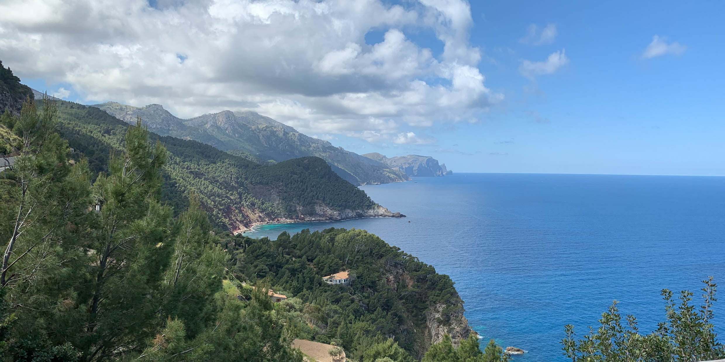
The first half runs through the Serra de Tramuntana, a UNESCO World Heritage cultural landscape since 2011. The Lluc monastery, Mallorca's spiritual heart, is a short detour off the Ma-10. Robert Graves lived in Deià and is buried there; Chopin and George Sand spent the winter of 1838–39 in Valldemossa's Charterhouse. Below Son Marroig, once the estate of Archduke Ludwig Salvator, the pierced rock of Sa Foradada juts into the sea. Banyalbufar's dry-stone terraces and the Torre des Verger watchtower of 1579 follow. The quiet second half shows farming Mallorca: Ariany, a municipality in its own right only since 1982, and Artà, crowned by the walled Sant Salvador sanctuary. The finish lies beside S'Albufera, the largest wetland in the Balearics.
Climbs
- Length
- 9 km
- Avg. gradient
- 5 %
- Max.
- 9.4 %
- Top
- 537 m
- Length
- 8.5 km
- Avg. gradient
- 3.8 %
- Top
- 871 m
- Length
- 4.2 km
- Avg. gradient
- 4.9 %
- Max.
- 7.9 %
- Top
- 223 m
- Length
- 6.5 km
- Avg. gradient
- 4.4 %
- Top
- 421 m
- Length
- 4.7 km
- Avg. gradient
- 6.1 %
- Max.
- 7.5 %
- Top
- 412 m
- Length
- 4.2 km
- Avg. gradient
- 6.1 %
- Max.
- 8.4 %
- Top
- 467 m
Tips from our guides
- Take front and rear lights: at the top of Puig Major you ride through the roughly 400 m Monnàber tunnel, and there is a shorter one near Gorg Blau. On the full distance you may also finish at dusk.
- Outside the event there are no feed zones, so start early: the Es Grau café at km 116 closes at 17:00 on weekdays and 17:30 at weekends. In the flat half the course passes through Alaró, Lloseta, Selva and Artà – refill there.
- The Ma-10 between Sóller, Deià and Valldemossa is narrow and busy with coaches and hire cars from mid-morning – ride single file. The organiser flags dangerous rail crossings at km 70 and km 170 and a sharp left-hander at km 190 on the descent to Lloseta.
- Ride a light road bike with compact gearing (e.g. 34×30) – the climbs are long rather than steep. If 313 km in one day is too much, split it: day 1 Playa de Muro–Esporles (160 km, nearly three quarters of the climbing), day 2 the flatter remainder. From our shop in Can Pastilla the course comes closest near Santa Maria del Camí, about 14 km as the crow flies.
- Want to ride it as the real event, with roads closed section by section? The 2027 edition starts from Playa de Muro on 24 April, and registration opens on 6 October 2026. All 8,500 places for 2026 went within seconds, so be ready the moment it opens.
Did you know?
- The Mallorca 312 was first held in June 2010 with just 199 riders. The idea of riding around the whole island in a single day was born in a bar in Artà in 2008. source
- Just past the Monnàber tunnel in the direction of Lluc, a sign marks 875 m – the highest point of any public road in the Balearic Islands. The summit of Puig Major itself (1,445 m) is a military zone with restricted access. source
- Ariany, at km 242, is Mallorca's youngest municipality: it only split from neighbouring Petra in 1982. source
Places along the route
-
133 km
Coll de Femenia
The top of the first real climb: 9 km from Pollença with five hairpins, finishing at 537 m. About 5 km later you pass the turn-off to the Lluc monastery – a short detour if you need water or a coffee.
-
249 km
Gorg Blau
The road skirts the Gorg Blau reservoir, which holds up to 7.34 million m³ of water for Palma and was opened in 1972 together with neighbouring Cúber. In the event this is the first food station; on your own ride there is none, so fill your bottles at Lluc. Shortly before, you pass the turn-off to the famous Sa Calobra road, which the 312 does not take.
-
356 km
Puig Major (Monnàber tunnel)
The highest point of the course, about 870 m, at the Monnàber tunnel below Puig Major (1,445 m), Mallorca's highest peak, whose summit is a military zone. The tunnel is about 400 m long, so switch your lights on. Beyond it the long descent to Sóller passes the Mirador de ses Barques with its view of Port de Sóller.
-
475 km
Coll d'en Bleda
Out of the Sóller valley, famous for its oranges, 4.2 km at 4.9% lift you onto the coast road. From the top the Ma-10 rolls high above the sea past the hamlet of Llucalcari to Deià, where the Reynés bakery sits right on the main road.
-
586 km
Sa Foradada
Below the road lies the rocky peninsula of Sa Foradada with its huge hole, best seen from Son Marroig, the former estate of Archduke Ludwig Salvator. The climb continues to Sa Pedrissa (km 88); then you skirt Valldemossa, where Chopin spent the winter of 1838–39.
-
6101 km
Sa Bastida
At km 97.7 the 312 turns right towards the sea and the Ma-10 drops to Banyalbufar, whose dry-stone terraces step down towards the water. Between Banyalbufar and Estellencs the Torre des Verger watchtower, built in 1579, stands at the Mirador de ses Ànimes.
-
7116 km
Coll des Grau
After Estellencs the Ma-10 climbs above the cliffs over Coll des Pi to Coll des Grau. Right here the Es Grau café has its self-service terrace over the sea. Then comes a 4 km descent, the second step up to Coll de sa Gramola (km 123.6) and a fast descent to Andratx.
-
8144 km
Galilea
In Es Capdellà (km 137) Bar Nou on the main street is a popular cyclists' stop. The 4.7 km climb that follows tops out at 412 m in Galilea, a village on the slopes of Puig de Galatzó; from the terrace by the church you can see far out to sea.
-
9158 km
Sa Granja
After Puigpunyent and the 18 hairpins of Coll des Grau de Superna you drop to La Granja, the estate Count Nuno Sans handed to the Cistercians in 1239. It was a museum for decades, but the estate was sold in September 2022 and the museum closed. Two kilometres on, in Esporles, the mountains are over.
-
10286 km
Artà
The last sizeable town before the finish, with the walled Sant Salvador sanctuary above its rooftops. In the event this is the final food station. From here it is 27 km on the Ma-12 via Can Picafort to Playa de Muro.
More routes
All routes →Similar rides from the same start in Can Pastilla.