Route no. 2 · start & finish Can Pastilla
Cala Pi
- Easy
- 63 km
- 371 m
- ≈ 2½–3 h
Map and elevation profile
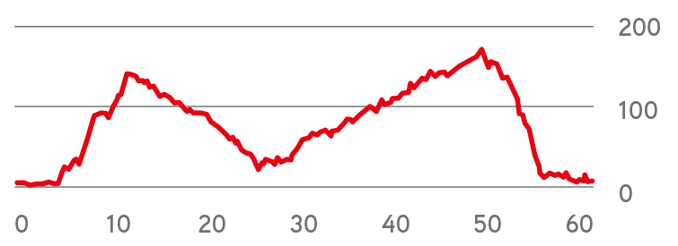
Move along the elevation profile to see where you are on the map.
Food & coffee stops
Tried-and-tested places where cyclists like to stop for coffee, food or water.
-
Restaurant 26 kmRestaurant Cal Miquel Cala Pi
Family restaurant on the rocks above the cove, founded in 1975 and reopened in 2026: market fish, grilled squid and seafood rice on a terrace overlooking Cala Pi. Opens at 1 pm, closed on Mondays.
Open in maps ↗ -
Café 45 kmCafé Colón Llucmajor
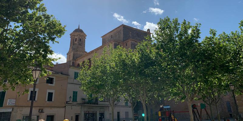
Café dating from 1928 with a terrace right on the main square, Plaça d'Espanya, which the route crosses at about km 45: coffee, toasts and sandwiches, with simple dishes at lunchtime. Opens at 8:30, closed on Tuesdays.
Open in maps ↗
Along the Coastline Towards Cala Pi Bay
Route summary:
This route with flat terrain through the south-eastern coastline of the island towards the stunning Cala Pi Bay is the top option for a warm up in the first days of your stay. The whole route takes between 2 and 3 hours depending on your average speed. We recommend stopping at Cala Pi about half way through the trip. The route will lead you through some narrow Mallorcan roads past the local farmsteads (fincas). During the ride, you will get some breath-taking views of the coastline. We recommend stopping at Cala Pi Bay, which is famous for its spectacular views. On the way back, you will ride through the town of Llucmajor, which offers numerous cafés surrounded by historical monuments like the Church of St Miguel from the 18th century. This route rip is better done in a group as the coastline can be quite windy.
 Cycling route summary:
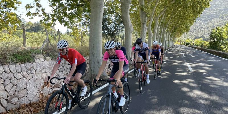
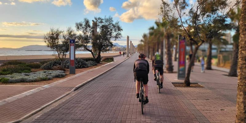
The first 5 kilometers will take you through the completely flat coast of s´Arenal. It will then switch into the slightly hilly part of the route. However, you will only climb to a height of 150 m above sea, in the next 7 kilometers. This will be followed by a roughly 14-kilometer gradual descent to the breathtaking beach of Cala Pi. Another 20 kilometers long ride to Llucmajor is on a narrow road lined up with the walls of Mallorca's fincas. You can hide there from any wind. The remaining 16 kilometers from Llucmajor are on the pleasant wide road. It will end with a 4-kilometer descent back to the coast. You will then arrive at the final destination in Can Pastilla.
 Tourist summary:
The start and end of this route are in Palma Aquarium. The beginning of the route is on the coast, then the route turns inland, to the main route destination by the sea. It is Cala Pi, the most famous and most beautiful beach on the Mallorca.
On the way back, you will be able to have a nice coffee in one of the many cafes in Llucmajor.
Climbs click to show on the map
- Arenal – Badia Blava (Ma-6014) from s'Arenal, Ma-6014 (31 m) 5.5 km · Ø 2 % · top 141 m km 6–12
Tips from our guides
- The climb out of s'Arenal on the Ma-6014 is 5.5 km at only about 2%. Spin an easy gear – from the top it is mostly a gradual descent to Cala Pi.
- Fancy a swim at Cala Pi? The beach is 147 stone steps down. Leave the bikes locked or guarded at the top and go carefully – cycling shoes slip on stone.
- The plateau road to Cala Pi has little shelter from the wind. Ride as a group and share turns on the front; the walled lanes towards Llucmajor are calmer.
- Cala Pi has only a few places to eat, and off-season they may be shut. Plan coffee in Llucmajor at about km 45 and carry a bar and a full bottle.
- On Wednesday, Friday and Sunday mornings the market fills Plaça d'Espanya in Llucmajor, right beside the route. Ride through the centre slowly or walk the bike.
Did you know?
- Right by the road, about 5 km before Cala Pi, lies Capocorb Vell, a prehistoric Talaiotic village with five towers, a listed monument since 1931. source
- The Cala Pi watchtower was completed in 1663 by master builder Joan Pons. Like the other coastal towers, it warned of pirates with smoke by day and fire by night. source
- Under Vallgornera lies the Cova des Pas de Vallgornera, found by chance in 1968. Over 74 km have been surveyed – the longest cave in the Balearic Islands. source
Places along the route
-
126 km
Cala Pi
Don’t look for the magnificent historic buildings in Cala Pi. The significance of this place is mainly in the beautiful beach, covered with white sand, crystal clear water and dramatically looking rock massive, protecting this incredible place reminding the Caribbean. This natural harbour has already attracted the first settlers of Mallorca.
Cala Pi beach got its name from the river Torrent de Cala Pi. It flows into the sea right there. The place is located in a very romantic bay. The beach is only about 45 meters long, but up to 140 meters wide.
-
229 km
Vallgornera
There is nothing breathtaking on the earth's surface, but beneath it. Lots of impressive caves, underground rivers, lakes and spectacular stalactites and stalagmites.
The most famous is the Cova des Pas de Vallgornera, which is the longest Balearic cave with a length of over 74 km.
-
346 km
Llucmajor
It is the largest city on the island in terms of its wide area, however the population is less than 12,000. The first historical records of the city date back to the 13th century. Definitely the most interesting historical event is the Battle of Llucmajor. It was a part of the war of independence of the Mallorca Kingdom in 1349.
Important city industry today includes tourism and footwear production.
The most famous monuments of the city are the Town Hall, the Church of St. Michael from the 18th century on Plaça Santa Catalina Tomàs and the monument of James III - Passeig Jaume III. Jaume III. fell in a memorable battle in the war for independence.
-
457 km
S ´Aranjassa
A small village on the route between Palma de Mallorca and the airport. Although it is a small village, with only 1,000 inhabitants, you will find there traditional architecture buildings.
More routes
All routes →Rides of similar difficulty you might also like.