Route no. 4 · start & finish Can Pastilla
Cap Salines
- Medium
- 148 km
- 880 m
- ≈ 5½–6½ h
Map and elevation profile
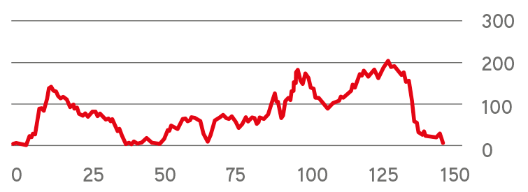
Move along the elevation profile to see where you are on the map.
Food & coffee stops
Tried-and-tested places where cyclists like to stop for coffee, food or water.
-
Restaurant 42 kmRestaurant Club Nàutic Sa Ràpita Sa Ràpita
Harbour terrace at km 40 with views of the boats and, on clear days, as far as Cabrera. Opens at 8 am – ideal for a first coffee. Closed on Tuesdays.
Open in maps ↗ -
Café 55 kmBar y Restaurante Estarellas Ses Salines
Bar with a terrace on the church square, about 150 m off the route at km 55: coffee and breakfast, later tapas and paella. Fill your bottles here – there is nothing at the Cap de ses Salines lighthouse. Opens at 8:30 (9:00 Fri–Sat), closed on Wednesdays.
Open in maps ↗ -
Café 85 kmSa Plaça Santanyí
Terrace on the main square, Plaça Major, about 500 m off the route at km 85, roughly halfway: coffee, a snack or lunch among the sandstone houses. Closed on Tuesdays.
Open in maps ↗ -
Café 105 kmCafeteria s'Abeurador Felanitx
Café with a terrace on the edge of the main square, Plaça d'Espanya, about 150 m off the route at km 105: coffee, almond cake and toasts at local prices. Opens at 6 am (7 am at weekends); closed on Tuesdays, and only until 3 pm on Sundays.
Open in maps ↗ -
Café 117 kmBar ca'n Guillem Porreres
Family-run bar with a terrace on the main square in Porreres, right by the route at km 117, with bike racks by the tables; cyclists are welcome. Open daily from 6 am – coffee or pizza before the last 30 km.
Open in maps ↗
Panoramic Route along the South-East Coastline
Route summary:
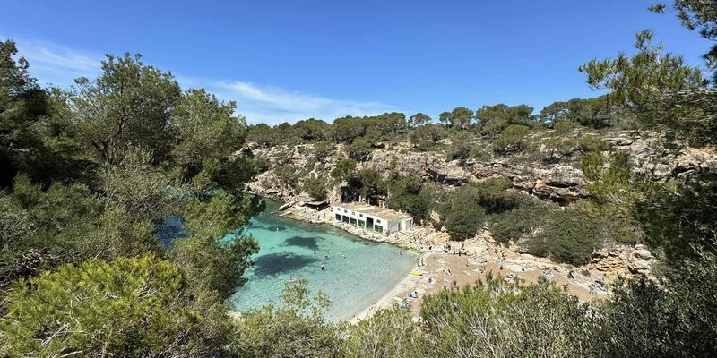
This route takes you to the island’s furthest point in the south along the south-east coastline. There are no significant climbs, and so the route is suitable for long, relaxed rides when working on general endurance. It is suitable for lower-performance riders under the supervision of experienced trainers. It is intermediate level. Completing the route will take between 4.5 and 6 hours depending on your average speed. The most suitable places for taking a break are Sa Rapita, Ses Salines, Santanyí, the main square in Felanitx and Porreres. Along the ride, you will get some stunning views along the south-east coastline. You will also get a view of the lighthouse and of the nearby island of Cabrera. Another interesting place is the small town of Ses Salines, which means ‘source of salt’. There you can see the lakes that are still used for salt production. On the way back, you can also stop in one of the small towns like Santanyí and visit one of many cafés or wine cellars. There is also the small town of Felanitx with its rich history and various cultural monuments. The view of the nearby Castillo de Santueri castle is breath-taking. Don’t forget to take some warmer clothes as the wind can be really cold here.
 Cycling route summary:
The highest point reached on the route is only 205 m above sea level. So, the flat profile of the route is quite obvious. Only at the beginning a slight ascent along the southeast will come on the way to Cap de Salines. This is followed by flat parts and a slightly descending part to the southernmost point of Mallorca. The 2 kilometer long climb will come afterwards, followed by a slightly hilly road profile between the towns Santanyí and Felanitx. Through a flat passage between Felanitx and Algaida, we will then reach the subsequent descent back to the Can Pastilla.
 Tourist summary:
The start and end of this route are in Palma Aquarium. The route will take you to the southernmost tip of the island. The first 21 km leads purely south along the coast. The route then turns slightly inland, until it reaches the southernmost part of the island, Cap de ses Salines, with the Far des Cap Ses Salines lighthouse. The way back goes through inland to the starting point in Palma Aquarium.
Tips from our guides
- Around midday a southerly to south-westerly sea breeze (the embat) picks up. Start early to ride the coast in the morning and save energy for the return, often into the wind.
- The road to Cap de ses Salines ends at the lighthouse, with no café or water there. Fill your bottles in Ses Salines; the next shops are in Es Llombards and Santanyí.
- The last kilometres to the cape are narrow, and in summer cars park along the verge. Ride single file and expect cars stopping or turning.
- Pack a windproof gilet: the wind at the southern cape can feel cool even on a sunny day, especially in spring and autumn.
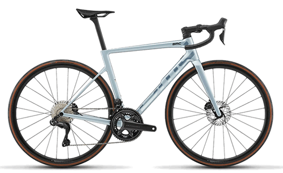
- With a high point of just 205 m, this is a ride for steady endurance pace or group riding. Any road bike works; compact gearing is more than enough.
Did you know?
- In the 1980s the Cap de ses Salines lighthouse became the first in Spain to run on solar power. source
- The islands on the horizon are the Cabrera archipelago, a national park since 1991. Today it is Spain's largest national park – and about 99% of it is sea. source
- Felanitx is the birthplace of painter Miquel Barceló (1957), who covered the entire Chapel of Sant Pere in Palma Cathedral in terracotta. source
Places along the route
-
140 km
Sa Rapita
Sa Rapita is a town whose main task in the 16th - 19th century, was to warn the population against fires and pirate attacks, coming from the south.
The Son Duri watchtower is still standing. It still looks like it is looking for ships with a pirate flag on the mast.
Today it is one of the places with the most beautiful beaches on the island. The historic center has a pleasant atmosphere and the option of shopping in local, traditional shops.
-
254 km
Ses Salines
Ses Salines is one of the southernmost towns on the island. Its name means "salt source". Salt production has always been the famous in this town. In addition to salt, honey is one of the favourite souvenirs from local shops.
You will find the Botanicactus botanical garden close by. It covers 15 hectares.
-
367 km
Cap Salines
The southernmost place on the island of Mallorca. The Far des Cap lighthouse has been welcoming all seafarers since 1863. It is visible from far away.
-
481 km
Es Llombards
Es Llombards is a charming village near the sea. The famous beach of Cala Llombards is close by. Don't miss the wonderful atmosphere of the local shops, bars and restaurants. The local market is a place to get to know about the local life. It is always open on Wednesdays and Saturdays.
-
584 km
Santanyi
The creative atmosphere of this town attracts many different artists from all over the world every year. You will find many galleries and workshops in the historic streets.
The locals all know each other, because they meet daily in the local cafes and wine bars on the main square.
The fortifications and the gate of Porta Murada, recall the past necessary defense against the pirates.
-
690 km
S ´Alqueria Blanca
A beautiful village with a central square with a famous local bakery, several bars, restaurants and cafes. If you like Italian cuisine, visit the renowned Bacco restaurant and taste the Italian food made of the local vegetables, meat and fish.
-
7104 km
Felanitx
It’s a local, regional town. Its history dates back to the Bronze Age. This place is famous for its wine industry. There were more than 60 distilleries, in this area, in 1749.
Capers are also very famous locally. The main daily attraction is the city center market with a rich selection of local products.
The main historical monuments are the Castell de Santueri, the Monastery of San Salvador with the adjacent fortress and the Church of San Miguel.
-
8117 km
Porreres
A small town with a seemingly sleepy atmosphere, but the appearance is deceptive. Its history date back to the Bronze Age. Arab and Roman settlements bring in mind wells, used to be used by humans or animals. The current city name was given after its conqueror, William of Porreres. A sad historical event is a small revolution called "famous", during which the town hall burned down with 600 years of historical documentation. It coincides with the fall of Queen Isabella II in 1868.
The main street is Avinguda Bisbe Campins. It is a pedestrian area with many cafés, bars and the Baroque church of Nostra Senyora de la Consolació.
If you like modern art, you might be impressed by the Salvatore Dali exhibition in the town hall. And of course, there is a traditional marketplace as well.
-
9130 km
Algaida
Algaida has a population of 4,500. The origin of the name can be found in Arabic. It means "base".
The first written records date back to 1232. The city's sights are the Mare de Déu de la Pau de Castellitx, pilgrimage chapel and several windmills. The city also has the oldest glass blowing factory in Mallorca. You can still see the local glassmakers producing art objects in the workshop of the Gordiola family.
More routes
All routes →Rides of similar difficulty you might also like.